-Monday October 11, 2010'
I woke up bright and early and got everything all my stuff together in the cold of the dark, early morning. Nick and I walked through the tiny streets of Trevelez from our hostel to the trailhead only to realize we could not start hiking as it was pitch black on the trail- at 6:30AM this morning there was no moon, just a vast expanse of stars twinkling in the sky. Nick went back to retrieve his flashlight and then we began our attempt to summit Mulhacén, the highest peak in continental Spain. I enjoyed the clearness of the night sky, the fading lights of Trevélez as we hiked further and further away, and then watching the sky fade into light as the sun appeared.
Quick Facts:
Mulhacén Altitude: 3,478.6 m (11,413 ft)
Trevélez Altitude: 1476 m (4,843 ft)
Vertical Gain: 2,002.6 meeters (6,570 ft)
Roundtrip Trail Length from Trevélez: 22 k (13.67 miles)
Location: La Sierra Nevada (The Sierra Nevada)
 |
| Hiking early on after the sunrise |
I should mention the early morning was quite cold, probably around freezing point. We didn´t have long pants or gloves so our only option was to keep moving for the body heat. We stopped at a hut to snack and change clothes as the sweat was uncomfortable in the cold. Shortly after though the sun started to warm things up a bit.
 |
| Big Country |
|
|
|
|
|
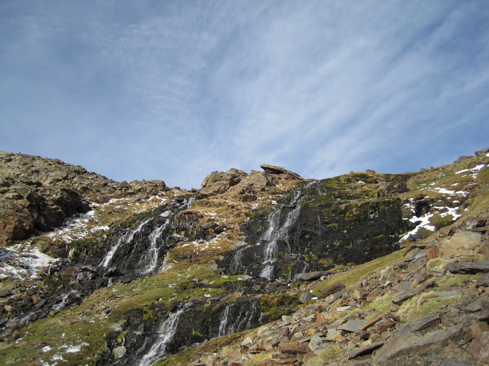
After a few hours we reached this incredible waterfall area, climbed steeply beside it and reached Siete Lagunas, one of the coolest spots in nature I have ever been!
 |
| Waterfalls |
 |
| Nick (sin camiseta) at Siete Lagunas |
 |
| Me at Siete Lagunas |
 |
| Siete Lagunas! To the left is the peak that makes up Mulhacén!! |
 |
| Final ridge, covered in snow and ice, before the clouds rolled in |
We hung out at Siete Lagunas for a bit and then trekked steeply up this cliff to get onto the final ridge of Mulhacén. Here we slowly started to encounter more and more snow and ice. At one point I had to use a rock to crush the ice to be able to plant my feet in spots that would not cause me to fall and slide off the cliff. My water bottle actually fell out of my bag and slid about 40 yards and straight off a cliff- yikes!!
Clouds started rolling in fast from the south. We were lucky enough to be able to see the Mediterranean Sea for a short period of time. Once the clouds came it became a bit dubious as to whether or not we should continue as we were reaching our cut off time for the day. Quite luckily, a patch in the clouds opened up enabling me to see what looked like people on or near the summit. We made the decision to push on and made it to the top!!
 |
| On the tippity top! Why am I clutching the small pillar? About 3 yards behind me is a couple thousand foot cliff!! |
 |
| Nick!! |
 |
| This is that cliff I was talking about! Straight down!!!! |
 |
| All these pics are with views to the North. The south was covered in clouds. |
 |
| Above the clouds!! Way up! |
 |
| View to the South (direction we came from). All clouds |
It took us seven hours but we made it to the top, and it was absolutely fantastic. Great views and incredibly rewarding. The photos speak for themselves!
We powered through the way down as it started to lightly snow and then rain as we decreased altitude. Overall trip was roughly 10 hours. We went out that night and celebrated with much deserved warm pizza and vino!
 |
| We were lucky to get the view we got early on in the day. This is on the descent. |
 |
| Super Free Range Cows |
We will post the rest of the trip soon!
-Michael
I am loving this, these trips are absolutely insane!!
ReplyDelete