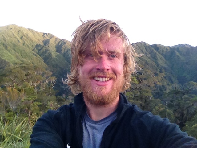
Friday, March 22, 2013

Te Araroa- Southland Pictures

Pictures include:
View from the Takatimus (pole)
View towards South Pacific from longwood forest (cool clouds)
Colac Bay school bus stop
Sunset at Oreti Beach
Several pics at Stirling Point, Bluff, the terminus of Te Araroa


Te Araroa - 141 Days Later and I've Walked the Length of New Zealand Via this Crazy Trail

I'm done! Yesterday evening, at around 6:30pm, Arne and I pulled into Stirling Point at the end of the Foveaux Walkway in Bluff, NZ. It was day 141 of my trip. As far as 'how do I feel?' 'how does my body feel?' 'it's a great accomplishment isn't it?' sort of questions, I'm feeling quite normal, my body feels fit, and I'm proud of myself for completing the trail. This trip's been a real adventure in myriad ways. It was mentally tough right through the last days as the trail never really let up (20km walk along the Bluff 'industrial line' highway yesterday is an example of mentally exhausting walking ha). I'm going to transcribe a section of my journal below. "3/19 - Live from Oreti Beach. Two day sremain on Te Araroa. Considering I have a full eleven/ten days remaining in New Zealand, the odds are in my favor to finish. Today was a cool beach/coastal walk from where Philipp dropped us off, on the road before Colac Bay, to the beach after Riverton. I totally underestimated the hardness of yesterday from Martin's Hut after a night/afternoon taking shelter from significant rain. It was an historic track next to an ancient gold mining 'race' aka it was a zigzagging net zero elevation change path with treacherous washouts everywhere. We assumed it'd be pretty easy, like the previous few days. It was not. I took a fall into a minor crevasse after slipping off a tree root. My chest slammed the roots on the other side of the gap and my right foot was dangling below my body several feet above a stream. Luckily I didnt hurt myself in any serious way. But it was emotionally draining. Also, both of my ankles were getting rubbed raw by my dirty ass socks. That also was tough. Arne offered me some of his tape, which helped a bunch. Also, washed socks this morning. Gross black water in sink five straight rinses. Philipp, now traveling with girlfriend Anna, found us walking towards Colac Bay. He drove a very small pink car. He was very happy to see us and we all laughed a lot last night. My abs were sore today from laughing (or maybe from my fall on the race track?). They (Philipp and Anna) made us spaghetti a la Badass Beni and then we had beers at the tavern conveniently connected to the Holiday Park office." So the day after that day I just wrote about, we walked into Invercargill during the evening and Arne was none too excited to go deal with 'city stuff' so we decided to just freedom camp on this walkway near the estuary which is part of Te Araroa. But there was a problem. We were due to finish the next day and were yet to purchase the champagne we'd dreamnt of opening at Stirling Point, Bluff. This led us to wander into the city. While wandering on a sidewalk, this lady pulled over and offered us a ride. She took us to the grocery store. But at the grocery store they sold no alcohol. So we went back outside to where she was waiting and told her the truth about us needing champagne and that we'd come on a long journey. She then brought us to the liquor store and we bought two bottles of champagne (actually 'sparkling wine' (11.5% alcohol content)). After talking more, we learned that she, a half scottish half samoan lady, traveled for endless years around europe/the world and she just invited us to pitch up our tents in her backyard. She lived in a one bedroom flat with her medical school studying brother. Things like this happen on the Te Araroa. Yesterday morning she drove us back to the estuary and we walked to Bluff mostly on the highway until the last 7km. Then we finished. Also, Will Nissan was going to meet up with me, but he caught the 'Invercargill Doldrums.' Ha. I'll post pictures soon. Looking forward to seeing everyone in the coming weeks/months. I'm back next Saturday night. Nick

Sunday, March 10, 2013

Te Anau

Today Arne and I hitched into Mossburn and learned the four square supermarket is closed on Sundays. Had an ice cream and a local guy offered a ride to Te Anau. Ha.

Last section, though relatively flat, was mentally a bit tough as we get closer and closer to the end but still have to walk there.

Shooting to finish the 21st.

Nick

Pics include:
Mountains
Arne at North Mavora Lake
Grass on Mavora Walkway


Monday, March 4, 2013

Live from Queenstown - Te Araroa

Hello all, The last post from Wanaka failed to 'publish,' while I was briefly in that friendly tourist town for a few hours of relaxing in the sun and a beer at the bar. It is now live for you, just imagine that it was posted on March 1 and your sense of timing won't be too affected. I am now in Queenstown and have completed 2700km of the Te Araroa. Only a couple more weeks of walking left. Hard to believe. Feet are still holding up. Shoes maybe not so much, but I'm going to see if they can make it. The last two weeks or so since Lake Tekapo have been quite badass in terms of long days and beautiful mountains. Feeling really good walking up the endless saddles and passes. Thru-hiking is a great way to spend a winter. Especially when you can walk in the southern hemisphere. Nick

Wanaka 2600km done on Te Araroa

Well, Arne and I walked a serious and beautiful stretch from Tekapo to Wanaka. It was a seven day stretch and included lake walks, mountain passes, river valleys, walking tracks and 'routes' which is basically walking without a trail next to a river or up to a saddle.
It's March here in NZ and I can see the days shortening. Four months on the trail is quite some time, but there's still more to come to reach Bluff, which is at the 3054 km mark. I don't fully trust the maps' measurements of km though.

Some random things: Arne and I created two (mostly) fictional dancing possums named Bob and Isabella, they wear Turkish Hats. We've been making lots of jokes about those two.

I threw out my Icebreaker t-shirt today after at least one month of there being outrageous holes in it that caused me to look even more like a hobo.

The next section of the track was made possible by Shania Twain as the kiwis made her build huts and the track in order to be a foreign land owner or some such randomness. It's supposed to be quite hard.

Pictures include:
Robert and Holly ( we walked with them for a few days) and Arne soaking up words of wisdom from Jim - who is the support team for his wife, Linda who is walking the South Island- at a lunch spot where he made us tea.

View of Mt Cook from our campsite on lake Pukaki

Arne crossing the Aruriri River

View of Mt Aspiring over lake hawea

View of pakatuhi hut


Thursday, February 21, 2013

Lake Tekapo

Ok,
Now residing in LakeTekapo Village. The terrain settled after Waiau Pass, but after crossing the Rakaia River the trail's been quite tough and fun. Lots of following rivers up mountains and then climbing up and over passes. No one but TA walkers and occasional hunters even visit the huts on this route. Really cool old Mustering huts.

Arne and I even did a couple of side summits. Up an unnamed 1800meter mountain west of Clent Hills Saddle and then up Mt Beuzenberg - over 2000 meters for first time- two days ago from Stag Saddle which at over 1900 meters is the highest point on the Te Araroa. The views from Beuzenberg and down the ridge are of the Southern Alps. Really awesome.

Pics are:
Sunset from near Lake Clearwater
Me on top of Beuzenberg
Southern Alps - quite glacial even in high summer
A hut in the mountains
Huge ridgewalk down from Beuzenber towards Lake Tekapo


Methven and Onwards!

Hello all,
I was unable to successfully 'publish' this post when in the town of Methven several days ago. Here it is.
After te supplying in Greymouth...
Cool section over Goat Pass the same day as the famous 'Coast to Coast' race. The fast ones run goat pass' 25km or so in three hours. It took me around 12 hours over 2 days.
Then walked from highway to Lake Coleridge. Mostly river valley walking.


Friday, February 8, 2013

Greymouth

Just walked 4.4 days from Boyle Village to the next highway on the way south. My ride to Greymouth was with a guy competing in NZs iconic "coast to coast" race which is happening on the very track we're walking tomorrow. Pretty cool. The guy, also named Nick, is hoping to podium in the cycling kayaking and mountain running trans island race.the walk through Harper's Pass was fine- following the Hope and Hurunui river valleys to the pass and then a different valley out to the road this morning.
Hope all's well with everyone back home, and that those in the northeast are camping out next to a ski mountain for this big storm!

The pics include:
Me in a morning hot spring jacuzzi
A swing bridge over the Hurunui River
View up towards Harper Pass ( I think)


Saturday, February 2, 2013

Randomly in Reefton

Yesterday, I finished off the Nelson Lakes - St. James walkway section of the trail. Nelson Lakes National Park is quite spectacular. Also, the weather stayed clear and sunny for the entire six day trip.

To connect from Nelson Lakes to the St. James, we climbed to Blue Lake Hut - next to what Kiwis claim to be the clearest and freshest water in the world. It is also incredibly cold, always between 3 and 8 degrees Celcius throughout the year. I took a quick dip and was mildly worried about giving myself a heart attack.

From Blue Lake Hut we had an awesome day to hike up and over Waiau Pass - at over 1800 meters the second highest point on the Te Araroa- which was super steep and fun. From there we dropped into the Waiau River Valley and walked a few miles to a camp spot called Caroline Creek Bivvy. There was a small herd of wild horses not far from where we camped.

The day following Waiau Pass I passed the 2000km mark of this journey. This is a good milestone as I'll only have 54km to walk after reaching 3000km.

So, after walking yesterday morning and reaching route 7, we (I'm walking with Arne and a Belgian friend of his who's walking two sections with us) ate the rest of our food and then walked to the side of the road and stuck the left thumbs out to try to get a ride 50km east to Hanmer Springs for a rest day and resupply. After 40 minutes of no luck Arne mentioned there's a town 70km west on the same road. "Oh yah, Reefton!" I exclaimed and with a bound I crossed the street and 20 seconds or so later the first car to drive west pulled right over and, though he only had room for one, I had to go for it. Arne and Wouter arrived in Reefton two hours after I did.

Next up is eating and relaxing in Reefton today and then hitching back to the trailhead to camp out this evening to begin the walk to Arthur's pass tomorrow morning. Reefton is a bit of a one horse town.

Pictures Include:
The Travers River
Blue Lake
View of Lake Constance from Waiau Pass
Me in the valley before ascending to Waiau Pass
The Waiau River Valley


Sunday, January 27, 2013

Onto Nelson Lakes

Richmond Range was awesome. Seven and a half days of walking and I made it, with Arne, successfully. It was awesome and hard and beautiful. I'm about to walk a couple hours into Nelson Lakes, the next section. Sorry for the short post- weather's turned summer down here.

Nick

Pics are from the Richmond Range and the Red Hills. My Rintoul, foggy picture, was our one day in the clouds.


Saturday, January 19, 2013

Live from Nelson

I walked the mellow and beautiful Queen Charlotte track earlier this week. Just hitched into Nelson to re-supply with 9 days of food (!) for the Richmond Range mountains. I'm meeting my friend Arne back at Pelorus Bridge and from there it's 115km or so to St. Arnoud on the southern side of the mountains. This is supposed to be the hardest section of the Te Araroa. Very exciting.
Also, I bought a full kilogram of chocolate for the next week+.

Pictures include:
-James Cook Memorial at Ship's Cove
- Three shots of the Marlbourogh Sounds (all three are the Queen Charlotte Sound I think)


Tuesday, January 15, 2013

South Island I Am Here

-Me at end of north island.
- And a shot of Marlborough Sound from the ferry.
- Wellington skyline on walk in
-pier at bottom of North Island

I'm about to take a boat to Ship's Cove to start the Queen Charlotte Track. Bit rainy.


Sunday, January 13, 2013

Pictures

Pictures include:
-me with my second to last carrot snack on top of mt puketematawai
- Tararua mountains x3
- Dracophyllum Hut (lunch on day 2)
- Me Arne Philipp and Beni at Beni's place in Otaki (thank you Beni!)


Saturday, January 12, 2013

Live from Wellington

Hello everybody!
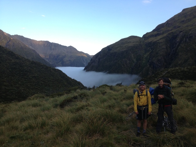
I'm live from Wellington right now.  Walked into the city yesterday afternoon, and have six more miles to walk until I've "officially" finished the north island section of Te Araroa.  Exciting stuff.  Since Palmerston North, I've walked with Arne and Philipp.  Philipp is 6'7" and came to New Zealand with absolutely no intentions of anything.  He realized that Germans have basically invaded the country on working holidays and decided to do something totally different from the rest of his country's tourists when he found out about the Te Araroa.  He's quite skinny and after the Tararuas, the three of us stayed with a trail angel, the first Kiwi to hike the entire Appalachain Trail, and we had the chance to weight ourselves.

I was down to 174 pounds after a giant meal.
Philipp lost 16 pounds and was quite distraught.
Arne somehow gained 5 pounds.

Since then I've decided to add enough room to my budget as to be able to eat as much as possible in an effort to put on a few pounds of fat to better survive the much more isolated and rugged South Island section of this trail.  There will be a lot less towns.

Here is a food list that I came up with for myself for the upcoming 7-10 day section on the famed 'Richmond Range,' theoretically the most isolated and tough section of the Te Araroa.

Peanut Butter: 875 grams
Choc/Nutella Spread: 400g
Cheese: 700-900g
Salami x2: 600g
Tuna/Sardines/Mackeralx5: 500g
Wholegrain Rice: 1500g
Chocolate Bars x4: 1000g
Muesli (granola) Bars: 420 g
Muesli Cereal: 1200g
Dried Nuts: 250 g
Dried Fruit: 250g
Onionsx3: 350g
Bread Product :800g
Hot sauce/Soy Sauce: 100g

This comes out to 18 to 20 pounds of food I intend to carry.  There won't be any towns for supplemental food and I really don't want to be super hungry.  Appetite is quite large at this point, but I think I'm getting back up near 180lb after the last few days of eating heaps and heaps of food.

The Tararua Range was actually closer to 10,000ft of elevation gain/loss a day.  We didn't even traverse the largest section of the range and it was the most up/downs I've ever done in such a short distance.  50km  or so in 3 days from Levin to Otaki Forks and we had 2 hot and blue sky days and one extremely windy/cloudy day.  The third day started with 3.5 miles of alpine walking up and over 4,500 ft. Mt. Crawford in wind conditions that required my ski mittens and all of us being relatively large male humans (this ensured we didn't get blown off the ridge into the abyss/gorges below).  After that, the next 14km of the day were also quite tiring because after lunch we were all out of food and the going was tough!I'm going to go to McDonalds next door to post pictures of the section.  Easily my favorite hiking of the Te Araroa so far.  We were out of food when we got to Otaki Forks, so I called Beni, the former AT thru-hiker, because his name and number are in my 'track notes,' and he came and picked us up and we camped out in his yard and got a huge dinner and breakfast and he showed us his photos of he and his brother Luigi's 1981 AT hike.
You could hear in his voice that the adventure was one of the prides of his life.  He was more than happy to be an amazing trail angel and drove us to the store and then back to the trail late the next morning.  Philipp's knee is bothering him, so he took the train straight to Wellington in order to rest and try to gain some weight back for the South Island.  Arne and I walked together the last four days which included a day in the woods, some road walking, some beach walking, some coastal path walking and then a cool windy ridgewalk just before entering the city yesterday from Colonial Knob to Mt. Kaukau and then into the city.  Wellington is full of some of the steepest streets I can imagine, much like San Francisco apparently.
Spent last night having a couple excellent Belgian beers (Arne insisted and who were Philipp and I not to oblige?) and then a few more beers in the harbour in the later evening + some cheeseburgers.  Feels good to have completed this crazy hike on the North Island (I'm going to officially finish it this afternoon/evening). I now need to make sure I can extend my Visa, I should be able to figure this out, and then it's on to the South Island! Hope all is well with everyone reading this, and thanks for following me, it's awesome to be supported from back home. Nick

Sunday, January 6, 2013

Live from Tararuas

This mountain range is epic. 6000 ft of elevation gain/loss today and tomorrow each.